Design 4 Public Value @ Sea
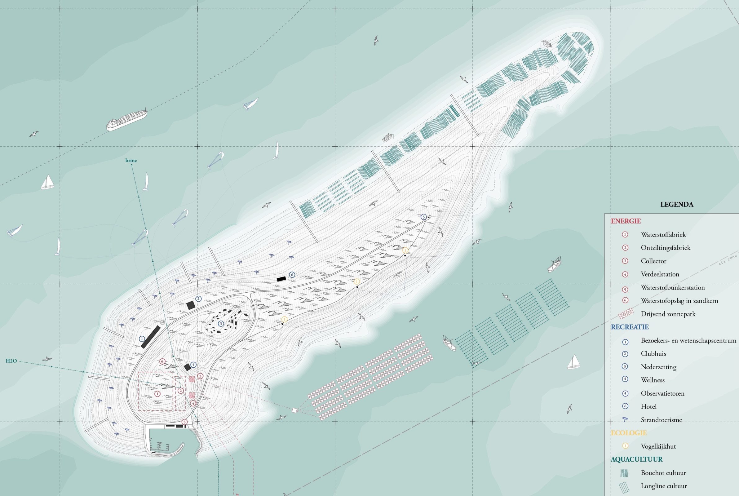
ORG engaged with multiple partners including, DEME, Jan De Nul, and Econopolis on a research project called Design 4 Public Value @ Sea, funded by Innoviris and Vlaio. The project looked at how multifunctional landscape infrastructures could have a public and environmental benefit for the Belgian coast. Marine Multifunctional Landscape Infrastructures' (MMLI) are multifunctional infrastructures at sea that can provide a multi-functional, integrated response to the climate challenges that we are facing. Think of artificial reefs that help to protect the coast, restore habitats and enrich biodiversity - sandbanks with aquaculture for coastal protection and food production - structures with energy storage, desalination, and aquaculture - etc.
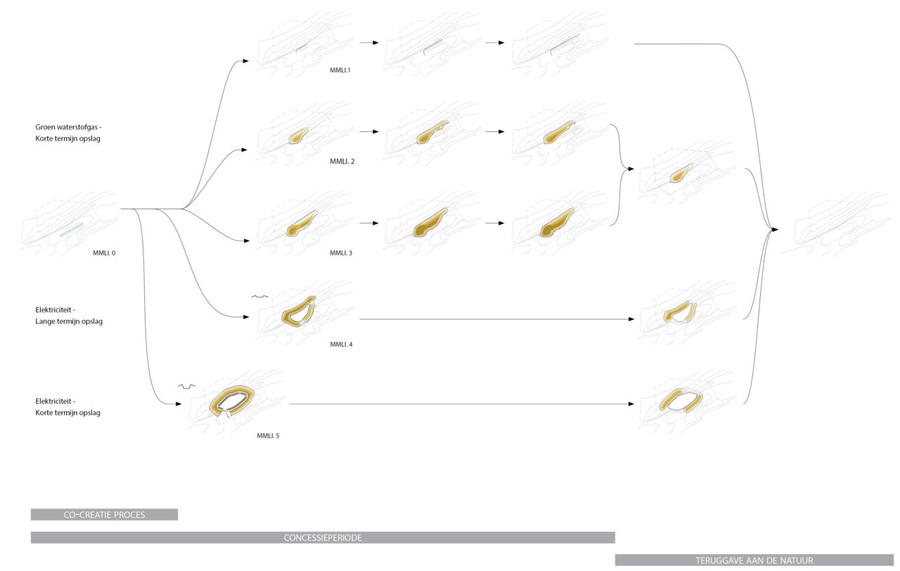
Such landscape infrastructures rarely reach the realization phase. This is not only due to 1. economic and 2. technical reasons, but also because too little attention is paid to 3. social support and 4. spatial integration. Part of the D4PV@Sea study is, therefore, in addition to a spatial study, also the incorporation of a co-creative aspect in which both supporters and opponents are involved from the very beginning in the design of these marine landscape infrastructures. Our research team has created a generic toolbox that can be used co-creatively for the creation of multifunctional marine landscape infrastructures around the world. An MMLI consists of two basic components: the surface and the functions programmed on it. Parcellation rules determine how these functions can be combined on the MMLI. A participatory strategy can then be used to invite co-creators to help shape an MMLI. As MMLIs have a dynamic character (the challenges they have to meet can change), the development strategies conceivable today are projected on a time scale. The future will show which course will be followed.
The surface of an MMLI
The possible configurations of an MMLI are determined by hydromorphological requirements, technical requirements, and the functions of the MMLI. In cooperation with IMDC and Jan De Nul, the hydro-morphological requirements were mapped out and possible MMLI shapes were determined with their corresponding technical profiles.
Parcellation rules for an MMLI
The various functionalities are then placed on an MMLI. This does not just happen. Spatial preconditions indicate whether the function should be located in the subtidal, the intertidal, or the supratidal zone. Within each of these zones, parcellation rules then determine how functions are efficiently combined. These rules derive from general principles such as 'efficient use of space', 'multiple uses of space', etc.
Location
North Sea, Belgium
Year
2019 - 2020
Area
6-10 km²
Program
Commercial, Infrastructure, Landscape
Collaborators
DEME, Jan De Nul Group, Econopolis, IMDC, Common Ground, TRACTEBEL – Engie
Mission ORG
Urban Research, Feasibility Study
Team
Alexander D’Hooghe, Timothy Vanagt, Elena Kasselouri, Caterina Dubini, Ivana Vukelic, Yannick Vanhaelen, Basil Descheemaeker, Mae Emerick, Heinrich Altenmueller
Clients
Innoviris.brussels, Vlaio – Flemish Agency Innovation & Entrepreneurship
Related Updates