
Lebanon High Mountains Master Plan
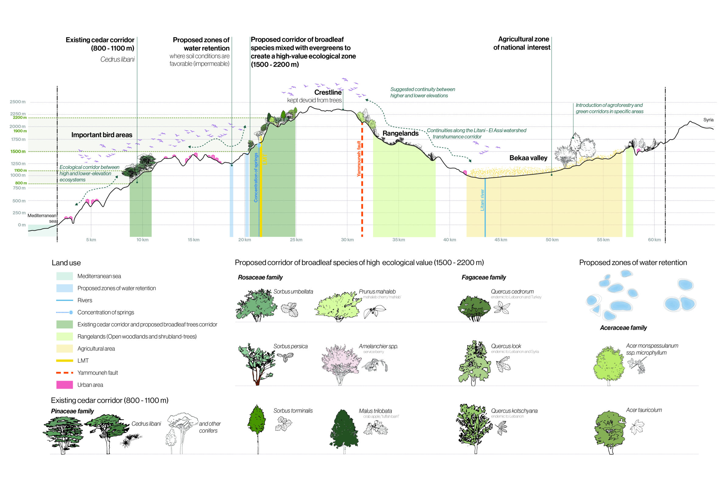
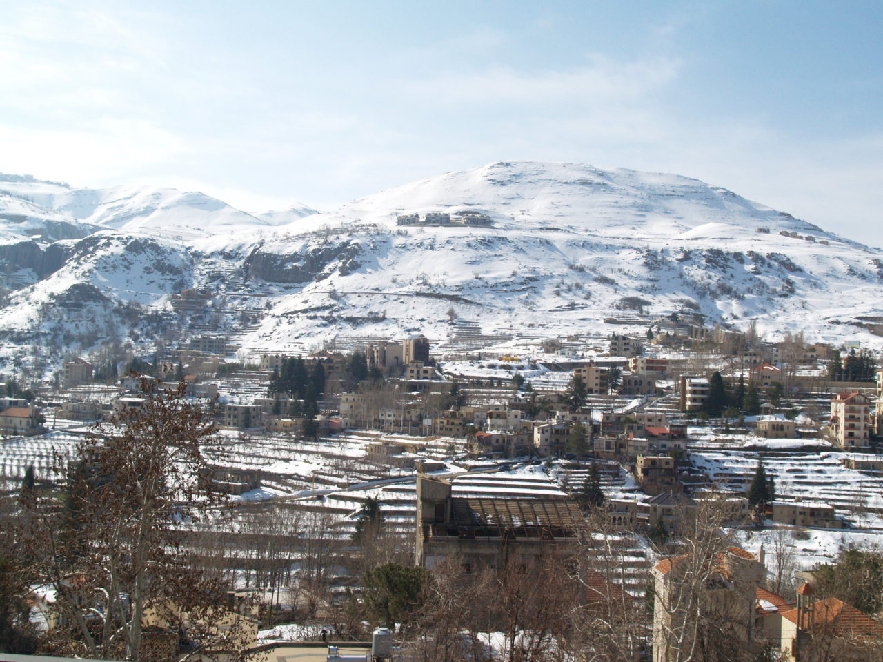
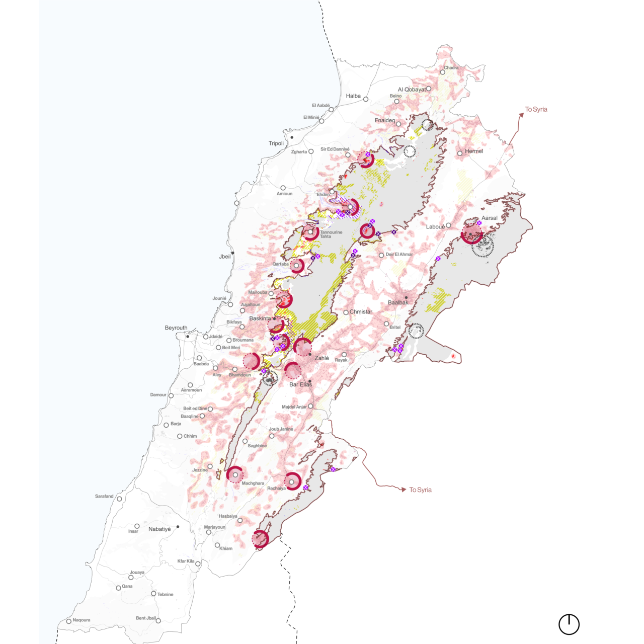
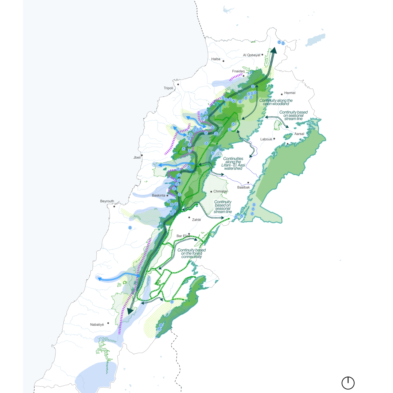
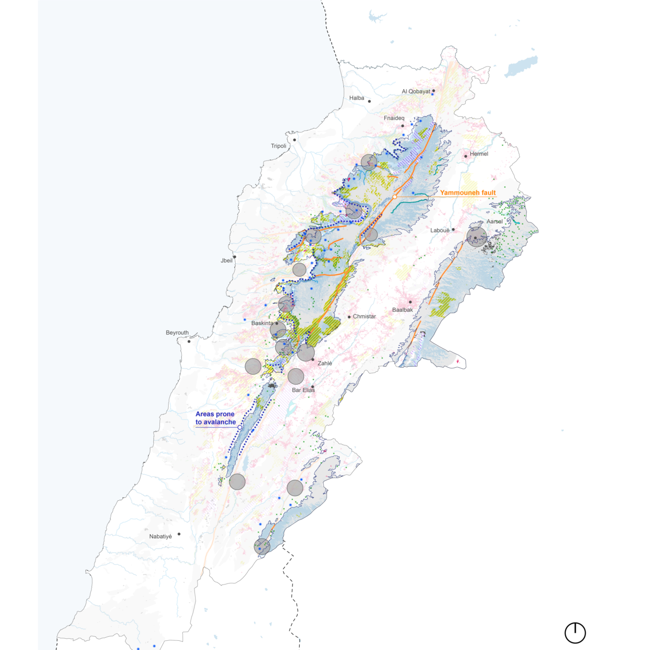
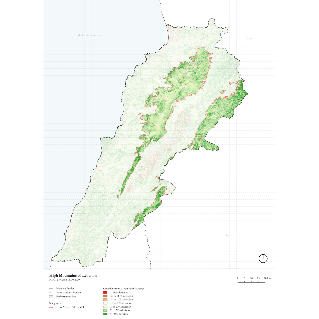
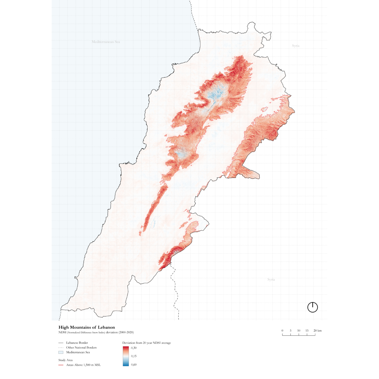
Mountains are a significant part of the Lebanese national territory, being the dominant topographical feature and a strategic freshwater reservoir. As the pressure for urbanization moves from the saturated coastal areas into other parts of the country, the mountainous regions are more and more in the process of absorbing development. This trend of irresponsible and uncontrolled development in the mountains inevitably leads to limiting or diverting storm water recharge, increased groundwater pollution, and the destruction of landscape and biodiversity at large.
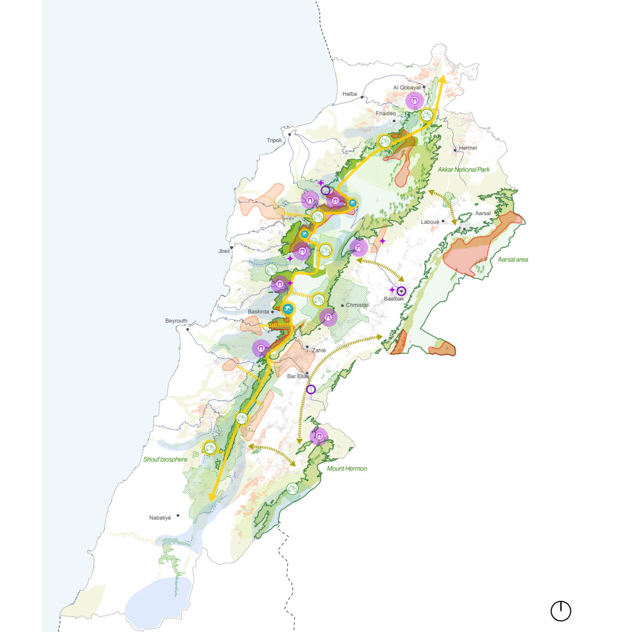
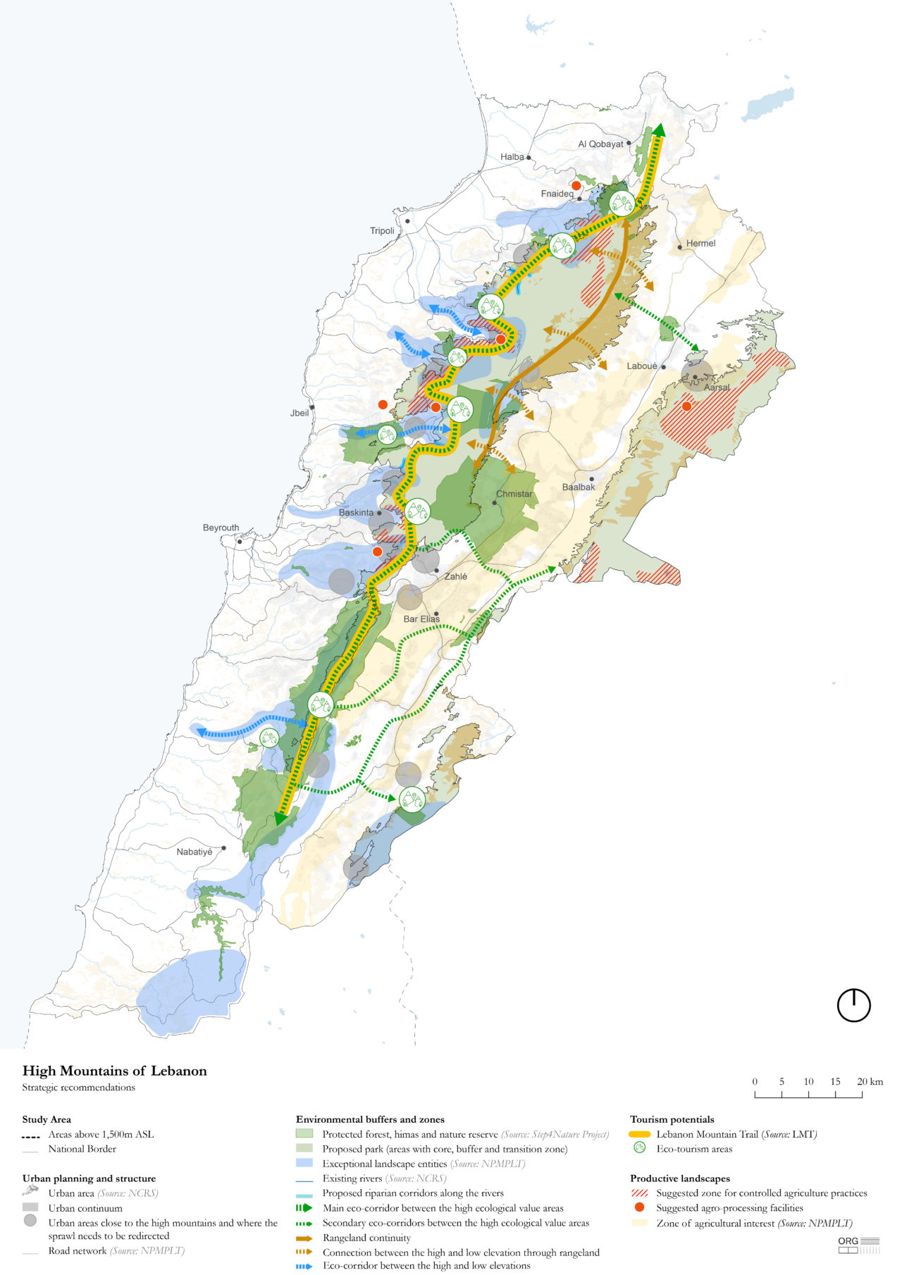
ORG Permanent Modernity was commissioned to develop master plans and local development action plans for the High Mountains (+1,500m and above) and two pilot districts Jbeil and Akkar (+800m and above), as well as detailed urban plans for the villages within the two pilot study areas.
The project mission is:
1. Elaborate a framework for environmental protection and valorization
2. Establish a comprehensive multi-sectoral vision
3. Promote sustainable land use within rural communities
4. Diversify economic growth in rural areas through cross-sectoral programs and projects
ORG managed a team of Lebanon-based experts in the fields of planning, agriculture and forest management, environment, geology, hydrogeology, culture and tourism, sociology, and economy, and developed a methodology to carry out the assignment over a period of one year and nine months between 2022 and 2024.
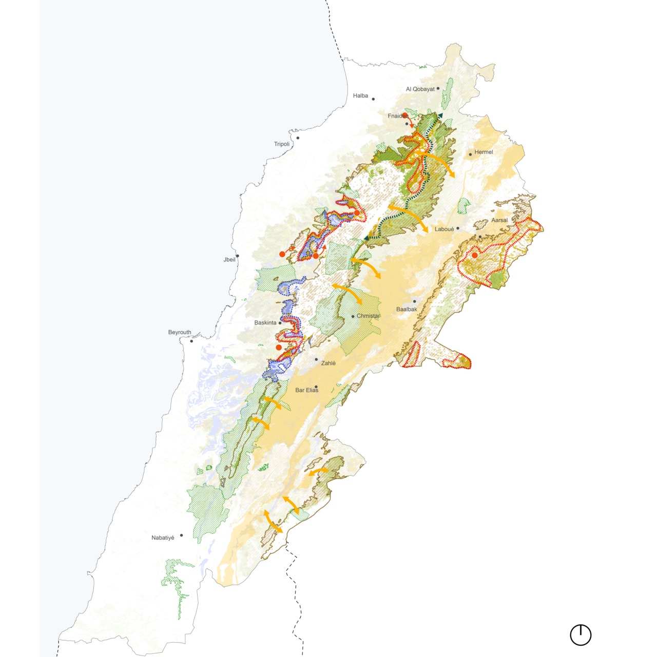
The main tasks included a thorough diagnosis of the main trends and challenges, which led to scenario projections, the elaboration of a vision and its subsequent sectoral recommendations, as well as local development action plans that translate the territorial visions into projects for implementation.
ORG, together with ELARD who oversaw the Strategic Environmental Assessment (SEA report), evaluated three scenarios for future development, all of which minimize negative impacts and maximize positive ones on the environment and population of the target areas. The best-ranked scenario encouraging sustainable land use management was used as a basis for the elaboration of the vision for the master plan.
The proposed master plans for the different study areas address the need for development for these rural communities while protecting and valorizing natural resources and ecologically rich areas and establishing zoning regulations that encourage sustainable land use management of the mountainous lands.
The Land Degradation Neutrality of mountain landscapes in Lebanon (LDN) project, funded by the Global Environment Facility (GEF) and implemented by the United Nations Development Program (UNDP) in partnership with the Ministry of Environment in Lebanon, seeks land degradation neutrality in mountain lands by rehabilitating degraded land and preventing further degradation. The project targets several levels of intent, national, regional, and local levels to significantly strengthen land use planning in Lebanon and especially the target regions. The project will work to mainstream considerations of land degradation neutrality into the Land Use Planning (LUP) process to achieve sustainable land and forest management.
Location
Lebanon
Year
2022-24
Program
Landscape, Spatial Analysis and Planning
Collaborators
Serge Yazigi Atelier, Redha Hamdan, Raji Maasri, Jean Stephan, Carole Atallah, Soumaya Ayadi-Maasri
Team
Alexander D’Hooghe, Natalie Seys, Luk Peeters, Garine Boghossian, Ricardo Avella, Rime Abbad El Andaloussi, Myriam El Khoury, Rana Bachir, David Birge
Clients
United Nation Development Programme


