
Boulevard of Europe - Europarklaan Genk
The city of Genk (pop 65,691) has a polycentric urban structure. The city is a grid plan, with a city center and various connections to important peripheral sites. The eccentricity of the area as a place with multiple centers makes Genk an atypical Flemish town, and along with its past industrial growth, it is a city with socially diverse nodes. The development of the Europalaan, the central transit corridor that passes through the area, will better link the town center and its peripheral focal points. Also, development around the Europalaan will take advantage of its connectivity to the wider Flemish Region, the Netherlands, and Germany.
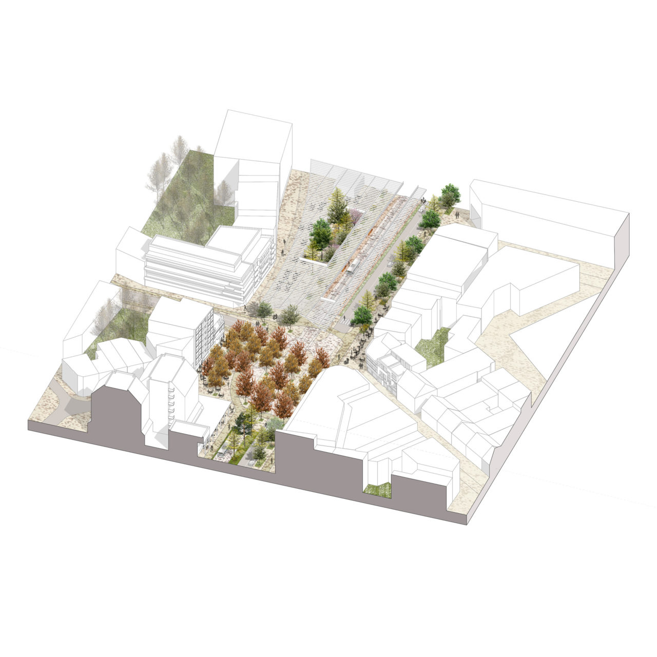
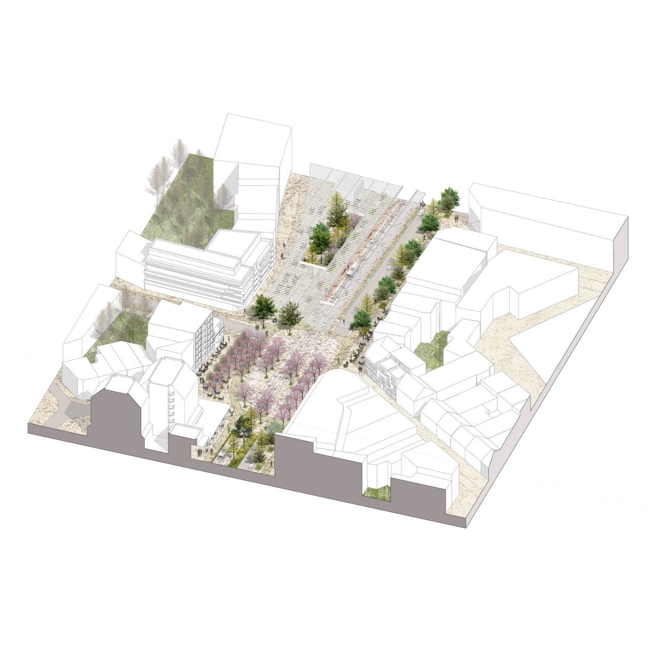
The competition brief called for a proposal to integrate a future tram lane, the Genk Central Station area site, and to identify and propose new development opportunities. ORG and ZUS won the competition with a clear framework for transit networks and a concept to enhance the town center as a green city. Currently, the central artery is a 4-lane auto-oriented thoroughfare. By reducing the number of lanes and optimizing transit dimensions, space is recuperated to increase the proportions of sidewalks, extend greenways from the periphery into the city center, and even delineate new parcels for development. Furthermore, instead of extending the center along the tram line outside the city center, we proposed to intensify existing sites and limit east-west urban expansion. The center is thus made more compact and denser, as a pedestrian-friendly work and leisure destination.
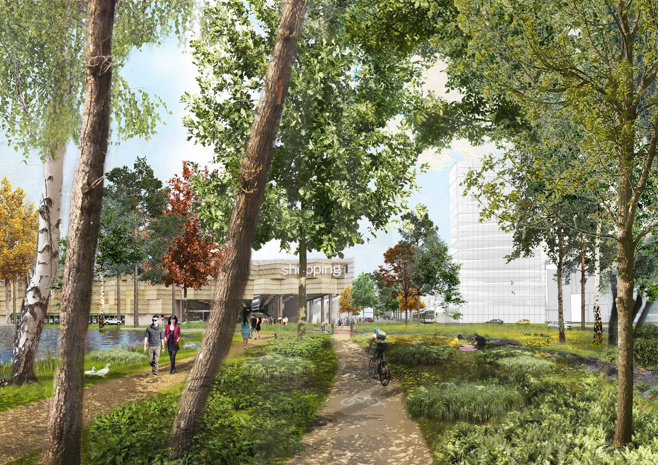
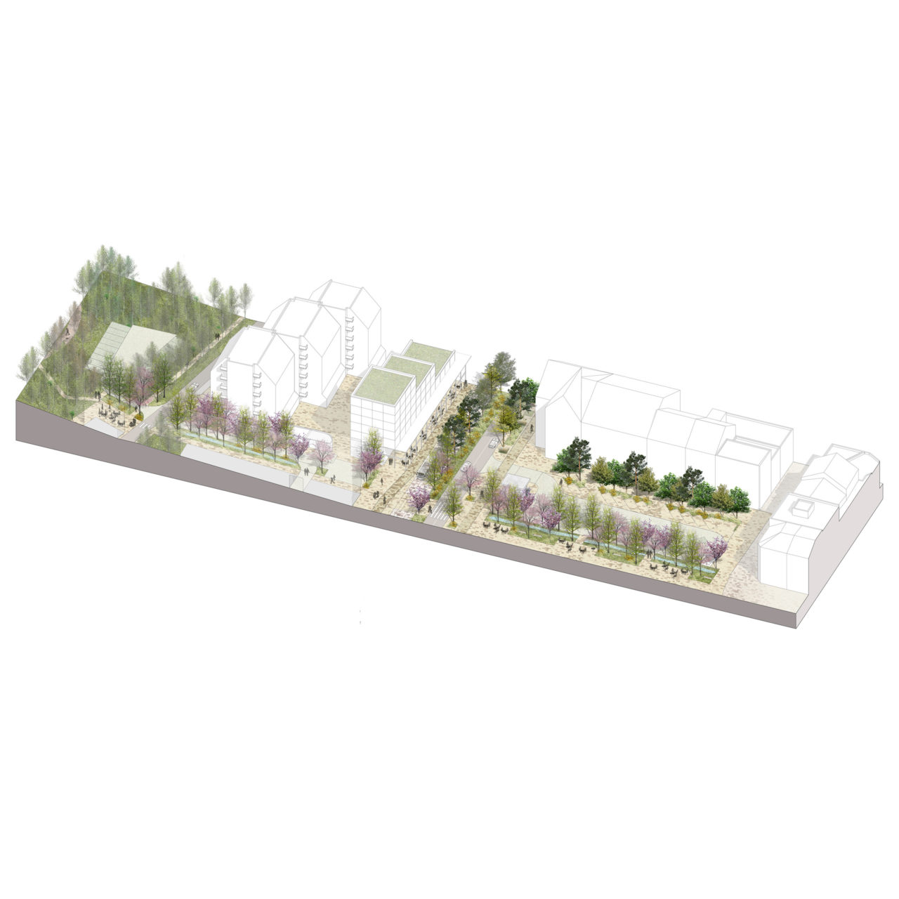
Outside the central artery district, the redesign of the Europalaan is an opportunity to restore the basic shape of the Dorpsbeek River Valley by making the transit corridor into a “Parkway.” The parkway concept separates car, tram, bicycle, and pedestrian networks and creates a thick natural corridor. The loosely bundled pathways that make up the parkway take advantage of topographical contours and natural features to create attractive connections to the surrounding focal points. The east-west parkway is complemented by north-south local routes. Here, the greenway concept is implemented as preexisting parks are joined into continuous paths, and even extended into the urban area to create a symbolic and substantial relationship between nature and city.
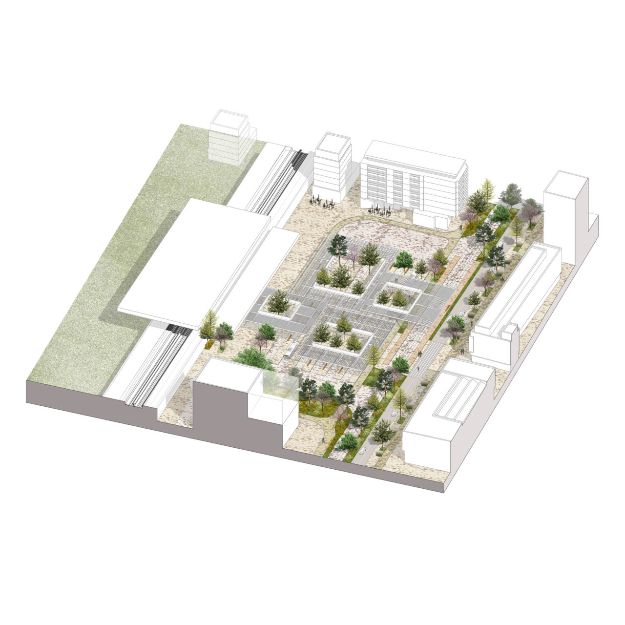
At these strategic pivot points, where new and old transit modes and nature and city come together, strategic interventions are defined. These architectural and landscape projects include a new multi-modal transit hub on the east end of the central artery, a public multicultural food market zone with a tram stop and office tower marking the west end, and numerous public spaces and mixed-use block developments at the nodes of the north-south connections.
Location
Genk, Belgium
Year
2015 -
Team
Alexander D’Hooghe, Marcel Smets, Birgit Clottens, Matthias Blondia, Michiel Dure, Doras Alver, Griet Kuppens, Aaron Weller, Kobi Ruthenberg
Clients
City of Genk
Mission ORG
Urban design
Program
Public Space, Transportation, Infrastructure, Landscape
Collaborators
ZUS (Zones Urbaines Sensibles), SWECO


